Fluvanna County, Virginia

175-foot towers. Not for Fluvanna's power.

A proposed 765,000-volt line could cut a 200-foot corridor through our farms, forests and river valleys. It is not final.

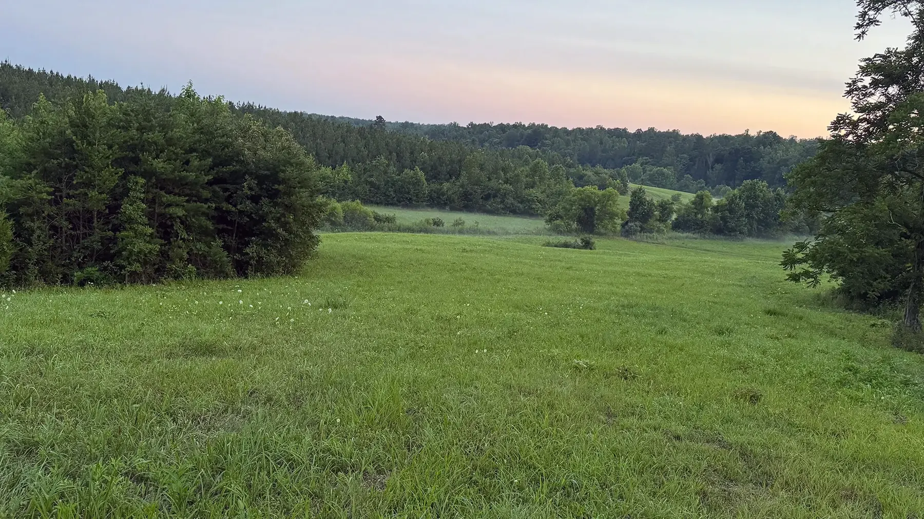
Evening light over a Fluvanna County pasture, with pines and hardwoods along the ridge
175 ftTypical towers run 150 to 175 feet
200 ftWidth of the new corridor
115 miCampbell County to Culpeper County
9Counties on the preliminary route, Fluvanna among them
~20 miRoughly 20 miles in Fluvanna on the preliminary options

Figures from Valley Link's published materials and its Fluvanna/Goochland Constraints Index (May 23, 2026). Routes remain preliminary.

Proposed. Not decided.

Residents can still shape what happens next. The strongest local record is built before the filing.

  1. Now

    Preliminary routes. Information is being collected and verified across a broad area.

  2. Filing

    Valley Link applies to the State Corporation Commission. Proposed and alternate routes are reviewed.

  3. Case

    Comments, discovery, hearings, agency review and expert work.

  4. Decision

    The SCC approves, modifies or denies.

No Valley Link application appears on the SCC docket, and no route has been approved. Revised routes are expected before or with an SCC filing. The SCC sets controlling deadlines after it accepts a completed application. As of late October 2026 we have not identified a filed application for the Joshua Falls to Yeat line. How the process works

Fluvanna isn't the reason.

The surge in electricity demand is farther north. The towers would be here. Their power demand. Our landscape.

Fluvanna isn't the reason Hand-drawn split scene. On the left, city and data center buildings with lit windows: where the demand is. On the right, Fluvanna farmland with a barn, trees and a river: where the impact lands. Between them, the proposed 765-kV line. Fluvanna does not have the surge in demand driving this project; the major growth is farther north; Fluvanna is not the customer but could bear a substantial part of the impact.

It's huge. And it could be permanent.

Easy to remember. Easy to repeat at the fence line, the church parking lot or the feed store.

It's huge: a 765,000-volt line on towers 150 to 175 feet tall Hand-drawn scale comparison: an adult about 6 feet tall, a two-story house about 25 feet, a 15 to 17 story building, and a 150 to 175 foot transmission tower, with a corridor about 200 feet wide. The line is 765,000 volts, with about 2 million homes of capacity per Valley Link.
Heights drawn to the same scale. Height and capacity figures are Valley Link's own published range.
The change could be permanent Hand-drawn Fluvanna countryside with a barn, trees, a fence, farmhouses and a river. A line of transmission towers grows larger across the hills, with wires running off the edge of the page. Notes: farms, forests, waterways, homes and historic places could all be crossed; towers up to 175 feet tall affect views well beyond the right-of-way; a corridor lasts for generations.
Illustration of Fluvanna farmland, not surveyed or to scale.

Learn the facts. Stay informed. Get involved.

Valley Link is proposed, not approved. Your local knowledge still matters.

Fluvanna Opposes Valley Link is a nonpartisan, citizen-led effort dedicated to informing Fluvanna residents about the proposed Joshua Falls to Yeat 765-kV transmission project and helping our community participate effectively in the public review process.

Learn the facts

Scale and setting. Valley Link describes a new 765-kV line of about 115 miles from Campbell County to Culpeper County, with roughly 20 miles in Fluvanna, and 150- to 175-foot-tall towers in a 200-foot-wide right-of-way. At this scale, the towers could be visible, and noise from the energized lines could be heard, far beyond the right-of-way.

Impact on Fluvanna. The preliminary route options would create new transmission corridors rather than use existing transmission line easements. To obtain access to the corridors, construction may be required beyond the proposed right-of-way, including for tower sites and work staging areas.

This is not a done deal. Routes are preliminary, not final. Route-specific access, construction and operational sites, and staging and restoration plans have not been presented. The State Corporation Commission will decide whether, and along what alignment, the project may be built after a public filing and review process.

Stay informed

Where are we now? No Valley Link application appears on the SCC docket, and no route has been approved. Routes remain preliminary and revised routes are expected before or with an SCC filing.

Start with current information. Visit FluvannaOpposesValleyLink.org and follow us on Facebook for updates, source links, maps and events. Local news, advocacy groups and community organizations can also help you follow the process.

Follow the public record. Watch the SCC docket, Fluvanna Board of Supervisors and Planning Commission meetings, agendas and materials, and Valley Link's public website.

Pass along reliable information. Tell your friends, neighbors, family and other community members. Encourage them to stay informed and get involved too.

Get involved

Your community involvement matters.

Create your own record. Official maps don't always show the full picture. Our self-guidance explains how to keep a dated record of the homes, farms, businesses, gathering places, historic sites, wetlands and wildlife habitat that matter to you, and how to protect sensitive locations.

Volunteer to help. We need help with public-source research, website and resource-guide support, writing, design, photography, outreach, and events. It will take a community effort to keep Fluvanna informed.

Host a presentation. Contact us to schedule a fact-based presentation for your organization or community group.

If built at this scale, it would make a generational change to Fluvanna's rural landscape. This is the time to document the farms, homes, environments and history that may be impacted or destroyed by this project.
Why it matters to you.

Pick the one that sounds most like you.

You do not have to live on a route for this to matter.

Towers up to 175 feet tall can change views and the feel of a community well beyond the edge of the corridor. A line like this tends to shape a landscape for generations, not years.

Neighbors in other counties along the route have raised concerns about property values, noise and the loss of rural character. Fluvanna should hear the facts before decisions are made about us.

Their power demand. Our landscape.

Join the list

What a map might miss.

A well-organized personal record can help you track what matters to you and prepare questions. A dated photo, a copy of the map you received or a family record can start it.

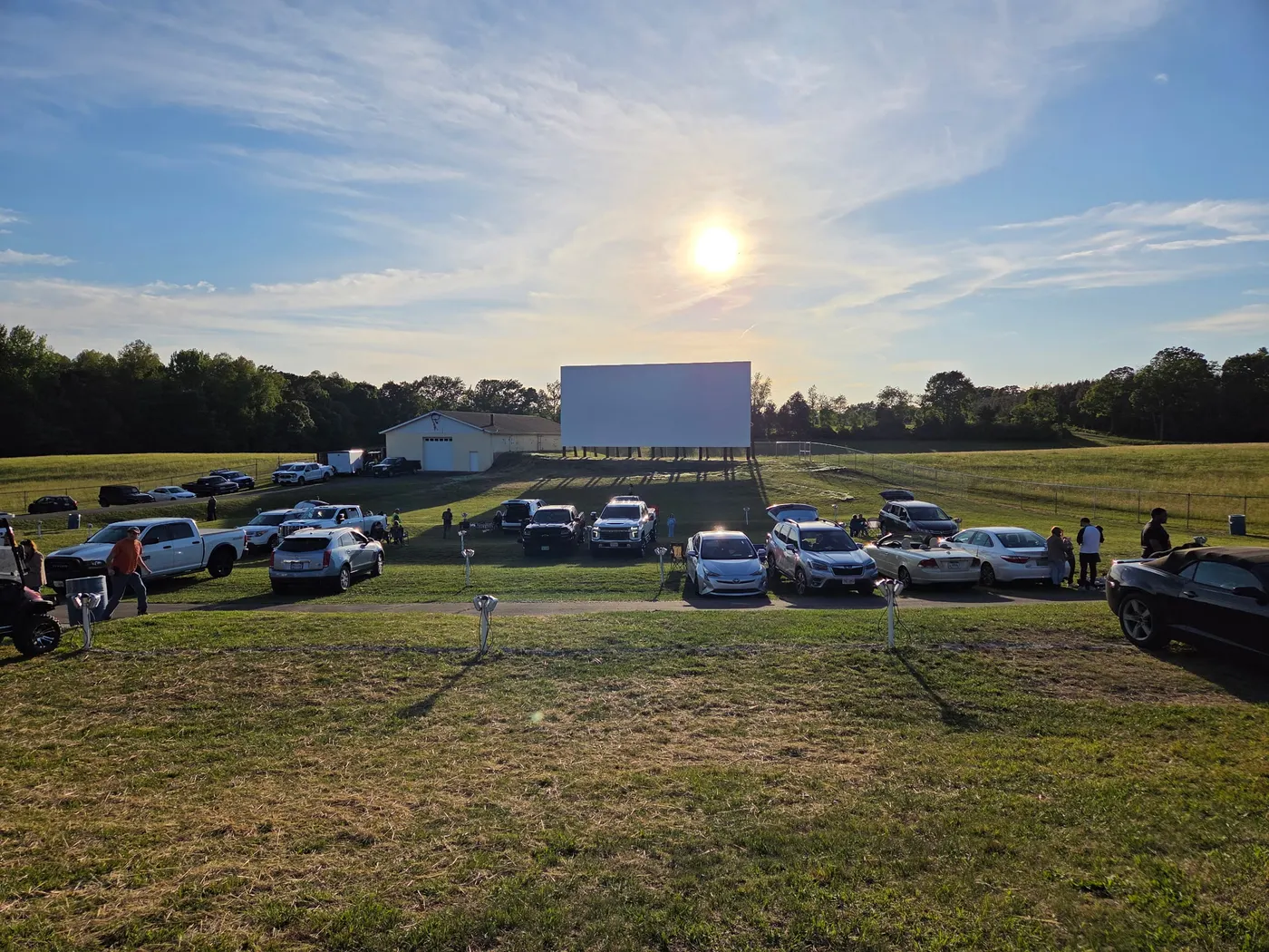
Cars gathered in the field at the Fork Union Drive-In under a wide blue sky
Fork Union Drive-In and the places neighbors gather
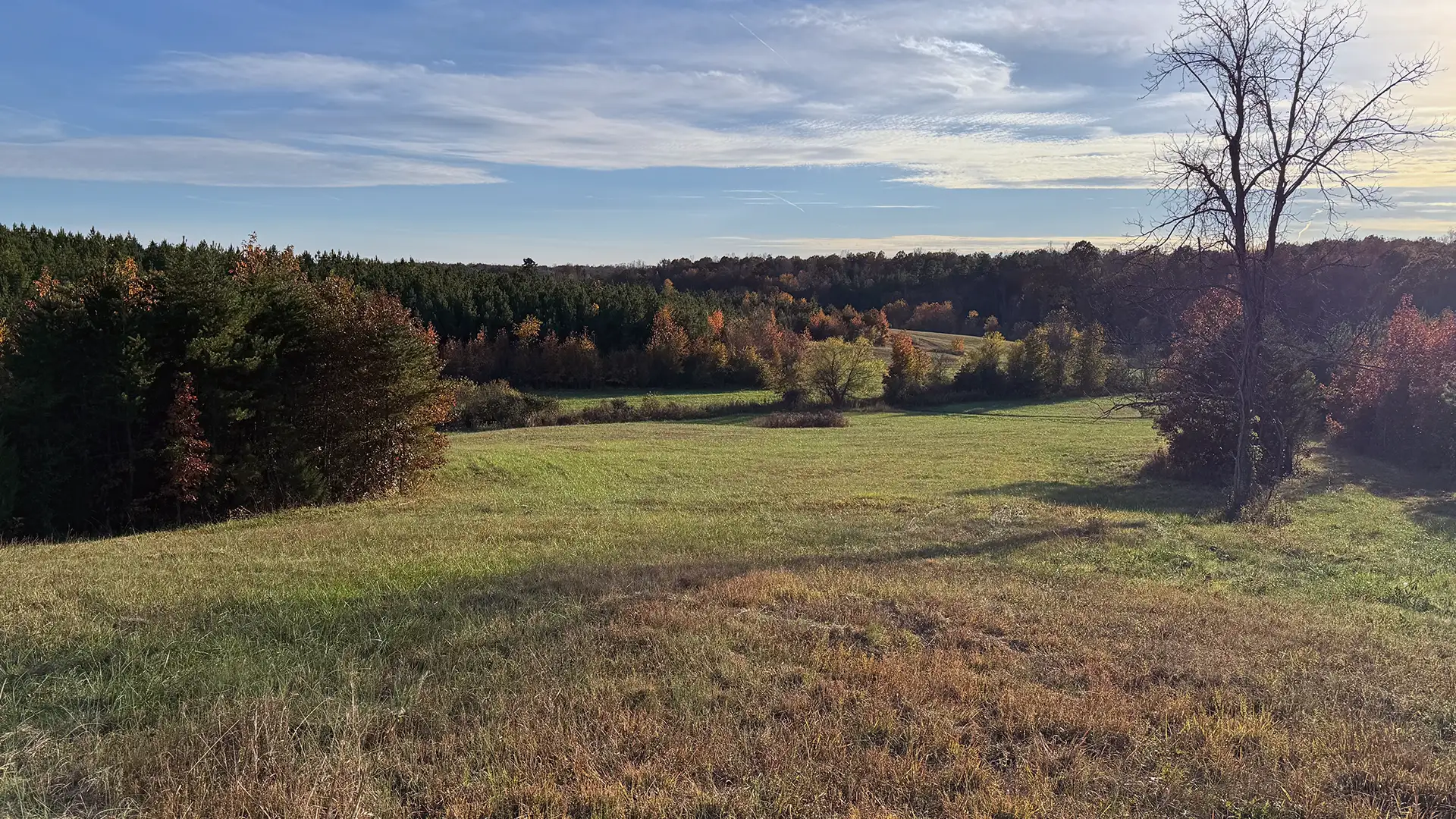
Quiet Afternoon Meadow In Fluvanna County
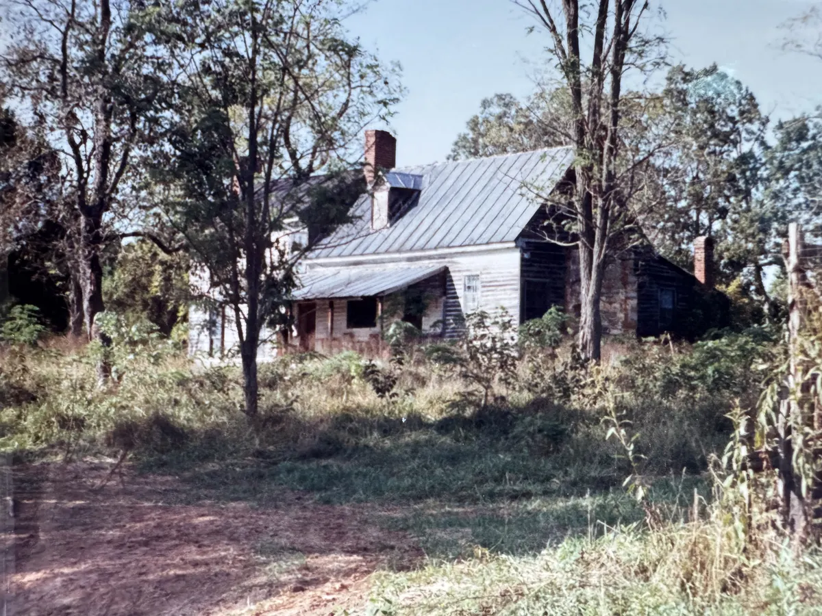
An old farmhouse with a metal roof surrounded by mature trees
Old homesites

Examples of what to document

  • Cemeteries and grave markers
  • Old roadbeds, mills and canal remains
  • Springs, streams and wetlands
  • Wildlife and protected species
  • Farms, forests and gathering places

Never trespass or disturb a grave, artifact or wildlife. Do not post sensitive locations publicly.

If your land may be on or near a route

Every property has unique features and local conditions, whether historic, cultural, environmental, agricultural or practical, that may not be visible on a map. If the project moves forward without those features being properly documented, important information about your property could be lost forever. Starting now can help you build your own dated record before the SCC considers the proposed routes.

You do not need to take a public position or tell us whether you support or oppose the project. You control your own records and decide what, if anything, to share, and with whom. If you share sensitive information with an agency, counsel or another reviewer, ask how it will be used and whether it could become public.

Careful documentation can give you a factual record to review with your attorney, appraiser or other advisor. We are not attorneys and do not provide legal, appraisal or negotiation advice, and we cannot promise that documenting a feature will affect an offer, change the route, or produce a particular outcome.

Maps often miss

  • Driveways and other access roads
  • Working fields
  • Livestock operations and the access needed for rotational grazing
  • Springs, wet-weather streams, wetlands and other groundwater-fed areas
  • Long-held family timber tracts
  • Wildlife habitat, including habitat for endangered or protected species
  • Historic features and cultural artifacts
  • Undocumented cemeteries or burial grounds
  • Churches and community gathering places

How to create your own record

This is general guidance from a volunteer group of private citizens, not a review of your property. County staff, agencies and counsel decide how a record applies to any review.

  1. Start with the basics

    Keep a dated copy of the map and notice you received, photographs, existing records, the source and date of each item, and the questions you want answered.

  2. Protect sensitive information

    Do not post sensitive cultural, historic, burial or wildlife locations publicly.

  3. Use the appropriate resource

    For a potential historic resource, environmental concern or technical question, consider the relevant public agency, qualified professional or counsel.

Fluvanna Opposes Valley Link remains a private citizen group. Volunteers do not represent themselves as County staff, County counsel, or technical experts outside their own individual qualifications.

Three things we are asking.

Before Fluvanna carries this burden, the people proposing it should have to show their work.

1

Prove the need.

Is this specific line needed, based on current and independently verifiable load and reliability data? How much of the claimed need is existing load and how much is not yet operating?

2

Examine the alternatives.

Existing corridors, upgrades, co-location and staged solutions should be fully and fairly evaluated before a rural county absorbs a corridor built for someone else's growth.

3

Minimize the harm.

Northern Virginia's growth should not automatically become Fluvanna's permanent landscape burden. Routes must protect homes, farms, forests, waterways and history.

Read the full list of questions that need answers

Many ways to help.

You do not need to be an expert. You need to be a neighbor who cares.

The simplest first step is the one that multiplies the others: send this page to three people.

  • Create your own recordDated copies of your map and notice, photographs and sources.
  • Suggest a public source or correctionA published map, notice, order or news report we should add or fix.
  • Research public recordsHelp build a verified, dated, source-linked resource guide.
  • Offer a skillWriting, design, photography, outreach, website support or nonprofit administration.
  • Photograph and documentFrom safe, lawful locations only.
  • Fact-check sourcesKeep the claims honest and traceable.
  • Host a presentationInvite us to your church, club, event or neighborhood.
  • Connect a local organizationIntroduce us to a group that should hear this.

Volunteer roles and expertise we need.

We need dependable volunteers for these practical roles, and we also welcome people who can contribute relevant professional, technical, or local knowledge. You do not need to be an expert to participate; a few hours a week devoted to a specific task can make a real difference.

  • Monitor the FOVL email account

    Review incoming emails and route general website questions, public-source suggestions and corrections for appropriate follow-up. Respond as appropriate.

  • Public-source research

    Find and cite published maps, notices, orders and meeting materials, and check each claim against its source.

  • Website and resource-guide support

    Help keep the site accurate, organized and easy to use, including the self-guidance and resource pages.

  • Writing, editing and communications

    Draft and edit updates, explainers and plain-language summaries.

  • Graphic design and photography

    Create clear visuals and photographs from safe, lawful locations.

  • Outreach and events

    Help with presentations, event staffing, yard signs, social-media updates, and talking with friends and neighbors about ways they can make a difference.

Make your voice heard.

Share how the proposed project may affect you, your community and the places you value.

Be heard in the SCC record

Submit comments or speak when the SCC's case-specific process provides an opportunity. Consider becoming a respondent if a proposed route directly impacts your land or livelihood. We can help explain that process. The SCC's case-specific order will determine whether a public hearing will be held and if so, where and when.

Take part in the SCC case
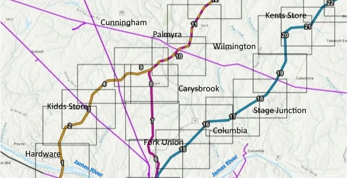
Map of preliminary Valley Link route options through Fluvanna County, July 2026, with numbered route segments near Hardware, Kidds Store, Fork Union, Columbia, Palmyra, Cunningham, Wilmington, Carysbrook, Stage Junction and Kents Store, and existing transmission lines shown in purple
Preliminary Valley Link route options through Fluvanna, July 2026. Map key: Gold, blue and magenta lines show preliminary Valley Link route options. Purple lines are existing transmission lines shown on Valley Link's source map. Routes are not final.

Write or call elected officials

Details verified September 23, 2026.

Regional and state advocacy organizations

Stay informed. Be counted.

Join the local update list for meeting notices, verified project information, SCC deadlines and ways to take part.

We are a nonpartisan, citizen-led group. We will never sell your information, and we will only write when there is something worth reading.

Join the Fluvanna list

How would you like to take part? Check any that apply.

We use your details to send requested updates and respond to general website, volunteer, or presentation inquiries. Please do not use this form to send private property records or sensitive information. We do not sell your details. See our Privacy Policy.

Quick sign-up. It takes about 30 seconds.

I would like

By joining, you agree to receive Valley Link updates and accept our Privacy Policy and Terms of Service.